

Inertial Sensors
Designed for Harsh Environments
Distortions, whether from magnetic and ferrous materials or electric current, can spell disaster for the standard sensor.
Sparton sensors, however, incorporate our proprietary AdaptNav™ solution and, in some models, gyro-enhancement to provide pinpoint heading accuracy. For us, no environment is too harsh and no terrain too unforgiving.
Considered one of the industry’s best performing inertial systems, the Sparton AHRS uses MEMS magnetometer, accelerometer and gyroscope technology. This provides seamless heading and position information even in areas where GPS signals are unavailable and GPS-based devices are unable to operate.
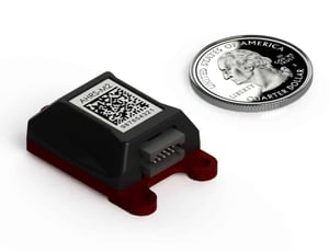
Disclaimer: Pictures do not reflect product size
Solutions
Learn More
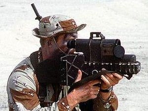
Defense and TargetingIn situations where precision is an absolute must, Sparton delivers the inertial sensors that can be trusted time and time again. Our products have been built to improve on today’s product standards with even greater performance than is required for tomorrow’s laser targeting systems.Learn More
Learn More
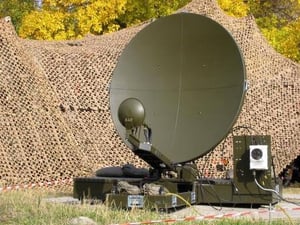
Antenna PositioningPanning the sky in search for satellite signals takes on a whole new meaning in urgent conditions when time is of the essence. Getting your connections established in short order requires absolute accuracy—accuracy that can only be delivered by Sparton’s inertial sensor systems.Learn More

Learn More
Unmanned SystemsUnmanned vehicles continue to impress with rapid advances in technology that make these vehicles suitable for military and commercial use. The inertial sensor is a critical component for unmanned operation success, and Sparton is lock step in the rapid development of sensor system technologies for, sea, and ground.Learn More
Learn More
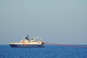
Surveying Land and SeaExploring the vast ocean floor for oil and gas opportunities is a daunting task. Sparton’s inertial sensor product offerings help produce the critical accuracy needed to survey, collect and analyze the sea floor to mine these natural resources.Learn More

“Sparton is poised for growth in the coming years and will expand its focus on products that serve the U.S. and allied maritime customers.” Kenneth Krieg, Chairman of Sparton’s Board of Directors said. “Donnelly is a well-known and trusted leader in the maritime market spaces where Sparton operates. She is the right person to continue our growth as the leading supplier of critical undersea warfare solutions to the U.S. Navy and its allies.”

Donnelly BohanCEO & President, Sparton and Vice President Maritime Systems, Elbit America
Products
Learn More
AHRS-M1The AHRS-M1 is the first micro-sized, light weight, low power Attitude Heading Reference System (AHRS) product with a revolutionary built-in adaptive-calibration mode. Learn More
Learn More
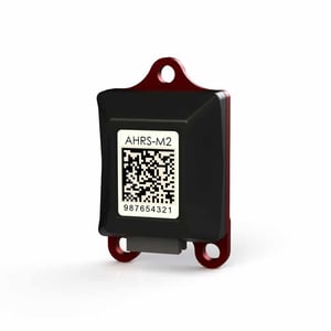
AHRS-M2Integrated AdaptNav™ provides real-time noise characterization and active gyro drift compensation for superior heading, pitch, and roll performance in electrically and mechanically noisy environments.Learn More

Have a Challenge?
We can help. Schedule a quick one-on-one call withspecialists from our Sales and Engineering teams.